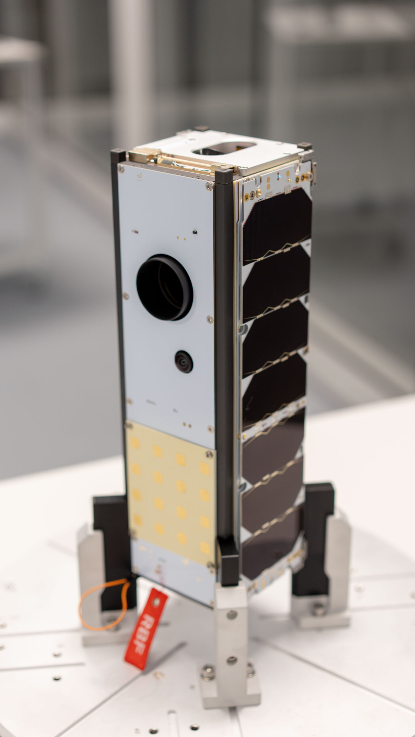
Kenya finally launched its first operational earth observation satellite on April 15.
The launch was scheduled for April 11 but got postponed more than once due to unfavorable weather.
Kenyan engineers from SayariLabs constructed and designed the satellite while Bulgarian firm EnduroSat aided in the testing and manufacturing of the parts.

Named Taifa-1, the NanoSat was launched on board the SpaceX Falcon 9 rocket from the Vandenberg Space Force Base in California, United States of America.
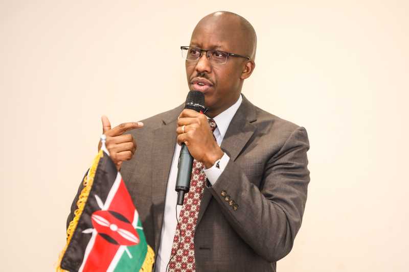
The acting director general of Kenya Space Agency (KSA), Brigadier Hillary Kipkosgey said the nanosatellite will provide valuable information about the composition and condition of the earth’s surface.
“The satellite can detect changes in agricultural farm produce and vegetation, monitor the infrastructural development of cities, and map the country.”
He said the insights gathered from the analysis of this data will provide useful information to policy and decision-makers in diverse fields who seek to address the challenges Kenya is facing.
Some of those challenges are food insecurity and dwindling agricultural production, caused by climate change effects such as prolonged drought.
“The 16m resolution panchromatic and 32m resolution multispectral imageries will be useful for decision support in environmental monitoring, climate change monitoring and mitigation, food security through crop condition monitoring and crop yield estimation, disaster management, and natural resources management, among others,” Brigadier Kipkosgey said.

Pattern Odhiambo, the communication subsystem lead in the satellite’s development, said Taifa-1 was inspired by Kenya’s challenges in food security, natural resource mismanagement, and internal and border security.
He added that the East African nation has always depended on foreign satellite services, which are costly and have limited access.
“The satellite can detect changes in agricultural farm produce and vegetation, monitor the infrastructural development of cities, and map the country,” he told Daily Nation.
“By monitoring farm inputs and yield changes over different seasons, farmers will adopt the best farming practices suited for Kenya’s unique conditions.”
Odhiambo said Taifa-1 will improve food security by enabling specialists to analyze crop health and compare yields across Kenya.
“By monitoring farm inputs and yield changes over different seasons, farmers will adopt the best farming practices suited for Kenya’s unique conditions,” he said.
According to the Food and Agricultural Organization (FAO), agriculture is key to Kenya’s economy, contributing 33 percent of the Gross Domestic Product (GDP) and another 27 percent of GDP indirectly through linkages with other sectors.
The sector also employs more than 40 percent of the total population and more than 70 percent of those who reside in rural areas.
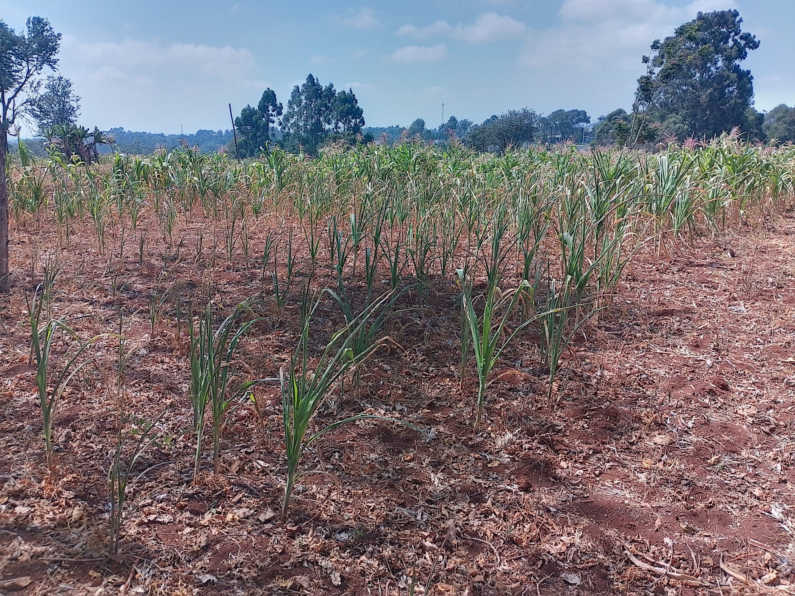
Kenya’s agricultural productivity has stagnated in recent years and in the last three seasons, crops have failed due to prolonged droughts.
This has been made worse by increasing costs of farm inputs such as fertilizer and seeds, diseases, and attacks from pests such as the Fall Armyworm, which caused losses of about one million tons of corn, a third of the annual production in the 2018 main season.
Brigadier Kipkosgey said the satellite will fly over Kenya roughly once every four days as it orbits the Earth.
“It is in that period when it is overflying Kenya — roughly seven minutes — that we will be able to download data,” he said, adding that the download will happen at a facility being set up in the Kasarani area of the capital city, Nairobi.
This is not Kenya’s first satellite, though. The country first launched a satellite in 2018, one year after the establishment of KSA.
The Precursor Flight (1KUNS-PF) satellite was developed by the University of Nairobi in collaboration with Sapienza University of Rome and launched into the International Space Station from Florida, US.
“It wasn’t able to do much in terms of giving us data. It was just a capacity-building tool. We have since learned from it,” said Brigadier Kipkosgey.
“Kenya cannot forever depend on vendors and other commercial operators to procure all space services; we have a responsibility to move with the rest of the world in developing capabilities that are fit for purpose.”
Then, the University of Nairobi said the satellite would be used to observe farming trends and monitor the coastline, and would also be crucial in testing technologies for the launch of a larger earth observation satellite in the future.
Taifa-1 has been fully designed and developed by a team of Kenyan engineers.
Brigadier Kipkosgey said the team underwent customized training on the space environment, orbital mechanics, space systems engineering, space operations, and project management to be able to understand and design a mission that would survive the extreme environment in space.
“As a sovereign nation, Kenya cannot forever depend on vendors and other commercial operators to procure all space services; we have a responsibility to move with the rest of the world in developing capabilities that are fit for purpose,” he said.

The Kenyan engineers include Major Hope Deche, who leads the ground receiver segment; Captain Aloyce Were, who oversees the structural and mechanical aspects and Rose Wanjiku Njogu who leads the thermal subsystem and Odhiambo.
Deche told the Daily Nation that the Kasarani station will allow engineers to monitor the satellite’s health and download collected data, which will then be pre-processed at the Mission Operations Centre before being ingested into geospatial monitoring and analysis tools for further examination.
“We had to partner with another entity that provides ride-sharing services. We expect these benefits to cascade down to common agriculture.”
“The data collected by the satellite will enable geospatial engineers to predict crop yields and analyze vegetation to determine whether crops are thriving or suffering due to suboptimal conditions,” he said. “With this valuable information, farmers can adjust their farming practices and take measures to increase productivity, ultimately improving food security in the country.”
Captain Were said the satellite was developed through partnerships.
“We had to partner with another entity in this case, Extra Launch, which provides ride-sharing services using SpaceX Falcon 9 launch vehicles,” he said.
“We expect these benefits to cascade down to common agriculture so that all people can be interested in the field.”
Main photo. [SayariLabs]